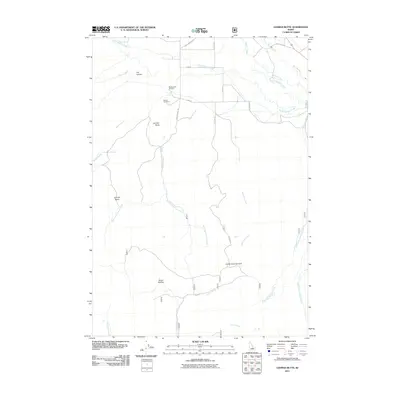
2011 Map of Lehman Butte
USGS Topo · Published 2011About this map
Big Lost River drainage patterns and high mountain terrain define this portion of Custer County as it appeared in the early 21st century. The landscape is marked by significant topographical landmarks such as Lehman Butte and the extensive Lehman Basin, while the valley floor is shaped by a network of waterways including Warm Springs Creek and Hamilton Creek. A key point of interest for local history is the Mackay Fish Hatchery, situated near Barton Cemetery at the base of the foothills. The presence of routes like Burma Rd and Old Chilly Rd illustrates the rural infrastructure connecting disparate grazing and water resources such as Horse Wallow and Wood Road Spring. This survey captures the transition from the irrigated valley bottoms to the high passes at Corral Creek Summit.
Find a feature on this map
31 named features on this map. Tap any name to fly to it.
Don’t see what you’re looking for? This feature index may not catch every label — zoom into the map to look around manually.
Map Details
Editions of this 2011 Lehman Butte Map
This is the sole edition of this map. No revisions or reprints were ever made.
Other maps of this area

1935 · MacKay
USGS Topo · 1:96,000

1935 · Borah Peak
USGS Topo · 1:125,000

1938 · Borah Peak
USGS Topo · 1:125,000

1940 · Mackay
USGS Topo · 1:62,500

1955 · Dubois
USGS Topo · 1:250,000

1955 · Idaho Falls
USGS Topo · 1:250,000

1958 · Dubois
USGS Topo · 1:250,000

1958 · Idaho Falls
USGS Topo · 1:250,000

1960 · Mackay
USGS Topo · 1:62,500

1960 · Copper Basin
USGS Topo · 1:62,500