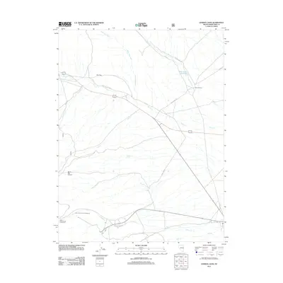
2012 Map of Lehman Caves
USGS Topo · Published 2012About this map
Bellander Ranch sits at the base of the mountain front, marking a pocket of settlement where Silver Creek flows toward the Silver Creek Reservoir. The drainage patterns here reveal a landscape defined by seasonal water flow, with Miller Basin Wash and Weaver Creek cutting across the alluvial fans. To the south, recreation and hydrology intersect at the Upper Lehman Creek Campground and Lower Lehman Creek Campground, which follow the course of Lehman Creek. Local infrastructure is captured through historic transportation routes such as Old 6-50 and Old Hwy 6, showing the evolution of regional transit. The map identifies specific water sources critical to the high desert environment, including Strawberry Spring and Bone Spring, which likely served as vital landmarks for early ranchers and travelers navigating the area between the Red Hills and Burnt Mill Canyon.
Find a feature on this map
24 named features on this map. Tap any name to fly to it.
Don’t see what you’re looking for? This feature index may not catch every label — zoom into the map to look around manually.
Map Details
Editions of this 2012 Lehman Caves Map
This is the sole edition of this map. No revisions or reprints were ever made.
Other maps of this area

1948 · Wheeler Peak
USGS Topo · 1:62,500

1949 · Garrison
USGS Topo · 1:62,500

1950 · Wheeler Peak
USGS Topo · 1:62,500

1951 · Garrison
USGS Topo · 1:62,500

1956 · Lund
USGS Topo · 1:250,000

1956 · Ely
USGS Topo · 1:250,000

1959 · Ely
USGS Topo · 1:250,000

1959 · Sacramento Pass
USGS Topo · 1:62,500

1960 · Lund
USGS Topo · 1:250,000

1963 · Ely
USGS Topo · 1:250,000