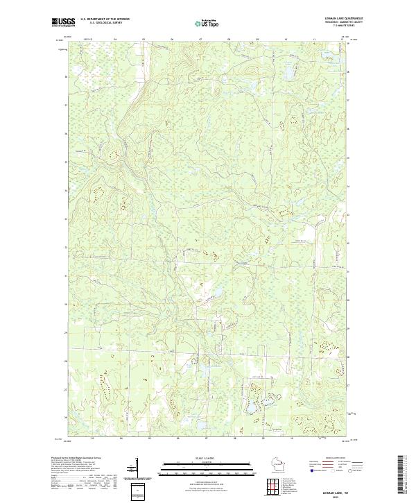
2022 Map of Lehman Lake
USGS Topo · Published 2022About this map
The Wausaukee River and its numerous tributaries and glacial lakes define this portion of Marinette County, Wisconsin. Small water bodies like Lehman Lake, Horsehead Lake, and Stovekin Lake are clustered in the northeastern corner, connected by a network of forest roads including Lehman Lake Rd and Bennett Rd. The landscape is characterized by its complex hydrology, with the Rosey Cr flowing toward Rosey Lake and the Meadow Brook drainage system cutting through the eastern sections. Transport throughout this timber-rich area relies on a grid of utility and fire access routes such as Firetower Rd and Tower Rd, which cross the township lines of t35n r18e and t34n r19e. Further south, the map reveals more secluded waters like Marbou Lake and Deer Lake, illustrating the dense wetland and forest patterns typical of the Northwoods.
Find a feature on this map
55 named features on this map. Tap any name to fly to it.
Don’t see what you’re looking for? This feature index may not catch every label — zoom into the map to look around manually.
Map Details
Editions of this 2022 Lehman Lake Map
This is the sole edition of this map. No revisions or reprints were ever made.
Other maps of this area

1939 · Dunbar
USGS Topo · 1:48,000

1939 · Goodman
USGS Topo · 1:48,000

1940 · Thunder Mtn.
USGS Topo · 1:48,000

1940 · Athelstane
USGS Topo · 1:48,000

1941 · Dunbar
USGS Topo · 1:48,000

1942 · Athelstane
USGS Topo · 1:48,000

1946 · Goodman
USGS Topo · 1:48,000

1947 · Dunbar
USGS Topo · 1:48,000

1951 · Thunder Mountain
USGS Topo · 1:48,000

1954 · Iron Mountain
USGS Topo · 1:250,000