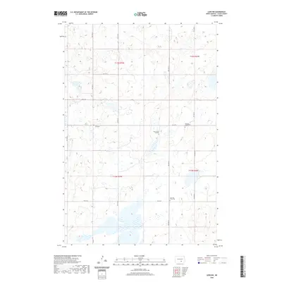
2020 Map of Lehr NW
USGS Topo · Published 2020About this map
Small rural burial grounds and isolated homesteads define this section of the North Dakota prairie, where the landscape is etched by a dense network of glacial potholes and wetlands. The map identifies several culturally significant sites for family history and local genealogy, such as the Sukut Family Rest Cem and the Emanuel Congregation Cem. These sites, along with Saint Lucas Cem and Hope EUB Church Cem, serve as the primary landmarks in an otherwise open, agricultural expanse. The section lines are clearly marked by gravel roads like 48th Ave SE and 70th St SE, which grid the undulating terrain and connect the dispersed farmsteads that characterize this portion of Logan County. The mapping of these small cemeteries provides a specific spatial record of early settlement patterns and the religious life of the rural communities that established themselves in the region.
Find a feature on this map
20 named features on this map. Tap any name to fly to it.
Don’t see what you’re looking for? This feature index may not catch every label — zoom into the map to look around manually.
Map Details
Editions of this 2020 Lehr NW Map
This is the sole edition of this map. No revisions or reprints were ever made.
Other maps of this area

1953 · Jamestown
USGS Topo · 1:250,000

1956 · Jamestown
USGS Topo · 1:250,000

1982 · Wishek NE
USGS Topo · 1:24,000

1982 · Lehr NW
USGS Topo · 1:24,000

1982 · Lehr NE
USGS Topo · 1:24,000

1982 · Lehr SW
USGS Topo · 1:24,000

1982 · Wishek
USGS Topo · 1:24,000
1982 · Lehr
USGS Topo · 1:24,000

1983 · Streeter SW
USGS Topo · 1:24,000

1983 · Streeter SE
USGS Topo · 1:24,000