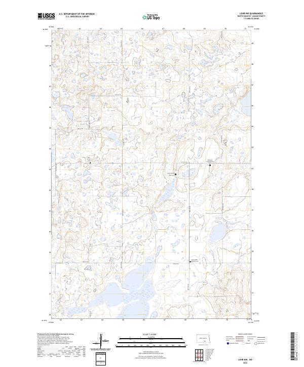
2024 Map of Lehr NW
USGS Topo · Published 2024About this map
Glacial prairie potholes and scattered wetlands define this portion of Logan County, where the Logan County Waterfowl Production Area spans several disparate tracts of land. This modern survey illustrates the enduring legacy of early Great Plains settlement through its preserved burial grounds. Small, family-oriented and denominational sites like the Sukut Family Rest Cem and Saint Lucas Cem are found along the section lines of the township grid, providing critical data points for genealogists and local historians. The landscape is primarily organized by a network of rural routes including 67th St SE and 70th St SE, which connect these historic community markers. Religious heritage is further evidenced by the Emanuel Congregation Cem and the Hope EUB Church Cem, which remain as prominent landmarks among the marshy terrain of the Northern Plains.
Find a feature on this map
17 named features on this map. Tap any name to fly to it.
Don’t see what you’re looking for? This feature index may not catch every label — zoom into the map to look around manually.
Map Details
Editions of this 2024 Lehr NW Map
This is the sole edition of this map. No revisions or reprints were ever made.
Other maps of this area

1953 · Jamestown
USGS Topo · 1:250,000

1956 · Jamestown
USGS Topo · 1:250,000

1982 · Wishek NE
USGS Topo · 1:24,000

1982 · Lehr NW
USGS Topo · 1:24,000

1982 · Lehr NE
USGS Topo · 1:24,000

1982 · Lehr SW
USGS Topo · 1:24,000

1982 · Wishek
USGS Topo · 1:24,000
1982 · Lehr
USGS Topo · 1:24,000

1983 · Streeter SW
USGS Topo · 1:24,000

1983 · Streeter SE
USGS Topo · 1:24,000