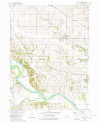
1980 Map of Leighton
USGS Topo · Published 1980About this map
The Des Moines River winds across the southern reaches of this landscape, flanked by the township boundaries of Scott and Jefferson. This 1980 survey reveals a countryside shaped by both agriculture and industry, where extensive Strip Mined Areas and Sandpits mark the terrain near the river's edge. The small settlements of Leighton, Olivet, and Tracy serve as focal points for the surrounding rural community, connected by the tracks of the Chicago Rock Island and Pacific railroad which cuts diagonally through the northern townships. Genealogy researchers will find several local burial grounds, including Evergreen Cem and Bellefontaine Cem, while conservation is represented by the Hull State Game Management Area. The presence of a Gaging Station and Landing Strip highlights the functional infrastructure of the Mahaska County region during this era.
Find a feature on this map
27 named features on this map. Tap any name to fly to it.
Don’t see what you’re looking for? This feature index may not catch every label — zoom into the map to look around manually.
Map Details
Editions of this 1980 Leighton Map
This is the sole edition of this map. No revisions or reprints were ever made.
Other maps of this area

1910 · Pella
USGS Topo · 1:62,500

1912 · Pella
USGS Topo · 1:62,500

1929 · Albia
USGS Topo · 1:62,500

1954 · Des Moines
USGS Topo · 1:250,000

1956 · Des Moines
USGS Topo · 1:250,000

1957 · Des Moines
USGS Topo · 1:250,000

1968 · Oskaloosa
USGS Topo · 1:24,000

1968 · Eddyville
USGS Topo · 1:24,000

1969 · Des Moines
USGS Topo · 1:250,000
1980 · Peoria
USGS Topo · 1:24,000