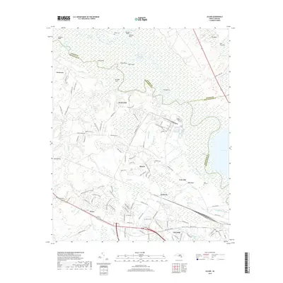
2019 Map of Leland
USGS Topo · Published 2019About this map
The Cape Fear River and Black River converge in this coastal plain landscape where Pender, Brunswick, and New Hanover counties meet. The convergence creates a complex network of wetlands and channels including Lyon Thorofare, Bulldog Cut, and the Black River Cut, surrounding significant river islands like Roan Island and Bill Neal Island. The southern portion of the sheet shows the expanding infrastructure of Leland and the industrial corridors of Navassa, centered around the CSX rail lines. Family history is well-preserved through numerous local landmarks, including the Mulberry Cem, Cedar Hill Cem, and Robinson Cem. Older settlement patterns remain visible in the small communities of Phoenix and Malmo, while the interior is defined by distinctive bays and swamps such as Wildcat Bay, Mitchell Bay, and Dollisons Swamp.
Find a feature on this map
140 named features on this map. Tap any name to fly to it.
Don’t see what you’re looking for? This feature index may not catch every label — zoom into the map to look around manually.
Map Details
Editions of this 2019 Leland Map
This is the sole edition of this map. No revisions or reprints were ever made.
Other maps of this area

1942 · Wilmington
USGS Topo · 1:62,500

1943 · Winnabow
USGS Topo · 1:24,000

1943 · Lewis Swamp
USGS Topo · 1:24,000

1944 · Winnabow
USGS Topo · 1:31,680

1944 · Lewis Swamp
USGS Topo · 1:31,680

1947 · Rocky Point
USGS Topo · 1:62,500

1948 · Wilmington
USGS Topo · 1:62,500

1950 · Winnabow
USGS Topo · 1:25,000

1953 · Florence
USGS Topo · 1:250,000

1953 · Beaufort
USGS Topo · 1:250,000