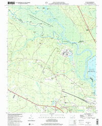
1997 Map of Leland
USGS Topo · Published 2001About this map
The confluence of the Cape Fear River and Black River forms a complex wetland landscape of islands and landings in this late-twentieth-century study of Brunswick County. Industrial sites like Davis Yard and several Industrial Waste Ponds neighbor the dense marshlands of Roan Island and Dollisons Swamp. These lowlands were vital for transportation, as evidenced by numerous river access points including Roan Landing, Peachtree Landing, and Strawberry Hill Landing.
Find a feature on this map
78 named features on this map. Tap any name to fly to it.
Don’t see what you’re looking for? This feature index may not catch every label — zoom into the map to look around manually.
Map Details
Editions of this 1997 Leland Map
This is the sole edition of this map. No revisions or reprints were ever made.
Other maps of this area

1942 · Wilmington
USGS Topo · 1:62,500

1943 · Winnabow
USGS Topo · 1:24,000

1943 · Lewis Swamp
USGS Topo · 1:24,000

1944 · Winnabow
USGS Topo · 1:31,680

1944 · Lewis Swamp
USGS Topo · 1:31,680

1947 · Rocky Point
USGS Topo · 1:62,500

1948 · Wilmington
USGS Topo · 1:62,500

1950 · Winnabow
USGS Topo · 1:25,000

1953 · Florence
USGS Topo · 1:250,000

1953 · Beaufort
USGS Topo · 1:250,000