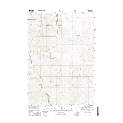
2014 Map of Lemhi Pass
USGS Topo · Published 2014About this map
Lemhi Pass stands as the central geographical and historical anchor of this high-elevation terrain, marking the boundary between Beaverhead National Forest in Montana and Salmon National Forest in Idaho. The Continental Divide snakes through the landscape, dictating the flow of numerous drainages including Agency Cr and Trapper Cr. This area is famously associated with the route of the Corps of Discovery, represented here by the Lewis and Clark Hwy. The map provides a detailed look at the complex hydrological system of the Bitterroot Mountains, with names like Ghoule Basin, Distant Fountain, and Magpie Gulch reflecting the early naming conventions of surveyors and frontiersmen. The western slopes are defined by deep canyons such as Bear Gulch, while forest roads like Frying Pan Rd provide access into the high timber of the Idaho-Montana borderlands.
Find a feature on this map
45 named features on this map. Tap any name to fly to it.
Don’t see what you’re looking for? This feature index may not catch every label — zoom into the map to look around manually.
Map Details
Editions of this 2014 Lemhi Pass Map
This is the sole edition of this map. No revisions or reprints were ever made.
Other maps of this area

1955 · Dubois
USGS Topo · 1:250,000

1955 · Dillon
USGS Topo · 1:250,000

1956 · Goldstone Mtn
USGS Topo · 1:62,500

1956 · Lemhi
USGS Topo · 1:62,500

1957 · Dillon
USGS Topo · 1:250,000

1958 · Dubois
USGS Topo · 1:250,000

1958 · Dillon
USGS Topo · 1:250,000

1962 · Dillon
USGS Topo · 1:250,000

1965 · Dillon
USGS Topo · 1:250,000

1965 · Lemhi Pass
USGS Topo · 1:24,000