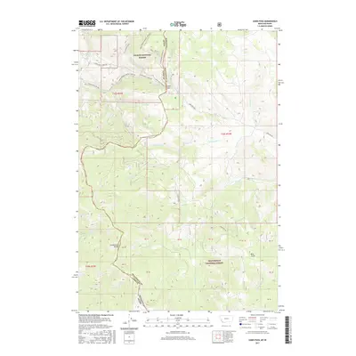
2017 Map of Lemhi Pass
USGS Topo · Published 2017About this map
Lemhi Pass marks the high-altitude crossing of the Continental Divide on this 2017 study of the Idaho-Montana border. The landscape is defined by the intersection of the Salmon National Forest and Beaverhead National Forest, following the historic route of the Lewis and Clark NHT. This corridor preserves the primitive character of the terrain encountered during the Corps of Discovery's 1805 trek, with modern access provided via the Lewis and Clark Hwy and the Warm Springs-Agency Loop Wt. Steep drainage systems such as Agency Cr, Bear Gulch, and Trapper Cr dictate the movement of travelers and water across the divide. The presence of Distant Fountain near the pass serves as a notable landmark for those tracing the path of western expansion through these protected forest lands.
Find a feature on this map
24 named features on this map. Tap any name to fly to it.
Don’t see what you’re looking for? This feature index may not catch every label — zoom into the map to look around manually.
Map Details
Editions of this 2017 Lemhi Pass Map
This is the sole edition of this map. No revisions or reprints were ever made.
Other maps of this area

1955 · Dubois
USGS Topo · 1:250,000

1955 · Dillon
USGS Topo · 1:250,000

1956 · Goldstone Mtn
USGS Topo · 1:62,500

1956 · Lemhi
USGS Topo · 1:62,500

1957 · Dillon
USGS Topo · 1:250,000

1958 · Dubois
USGS Topo · 1:250,000

1958 · Dillon
USGS Topo · 1:250,000

1962 · Dillon
USGS Topo · 1:250,000

1965 · Dillon
USGS Topo · 1:250,000

1965 · Lemhi Pass
USGS Topo · 1:24,000