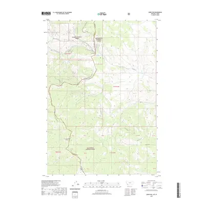
2020 Map of Lemhi Pass
USGS Topo · Published 2020About this map
Lemhi Pass marks the high-altitude transition between the Salmon National Forest and Beaverhead National Forest, serving as a critical point on the Continental Divide between Montana and Idaho. The landscape is defined by its legacy as a historic thoroughfare, traced by the Lewis And Clark Nht and the modern Lewis and Clark Hwy. The geography is carved by high-elevation drainage systems, including the headwaters of Agency Cr, Trail Cr, and the distinctively named Distant Fountain. This survey illustrates the convergence of recreational and historical paths, where the Continental Divide National Scenic Trail winds through a terrain of significant drainage basins like Frying Pan Cr and Bear Cr. The map's detailed boundary lines and survey markers emphasize the jurisdictional and natural barriers that have shaped movement through this mountain gap for centuries.
Find a feature on this map
47 named features on this map. Tap any name to fly to it.
Don’t see what you’re looking for? This feature index may not catch every label — zoom into the map to look around manually.
Map Details
Editions of this 2020 Lemhi Pass Map
This is the sole edition of this map. No revisions or reprints were ever made.
Other maps of this area

1955 · Dubois
USGS Topo · 1:250,000

1955 · Dillon
USGS Topo · 1:250,000

1956 · Goldstone Mtn
USGS Topo · 1:62,500

1956 · Lemhi
USGS Topo · 1:62,500

1957 · Dillon
USGS Topo · 1:250,000

1958 · Dubois
USGS Topo · 1:250,000

1958 · Dillon
USGS Topo · 1:250,000

1962 · Dillon
USGS Topo · 1:250,000

1965 · Dillon
USGS Topo · 1:250,000

1965 · Lemhi Pass
USGS Topo · 1:24,000