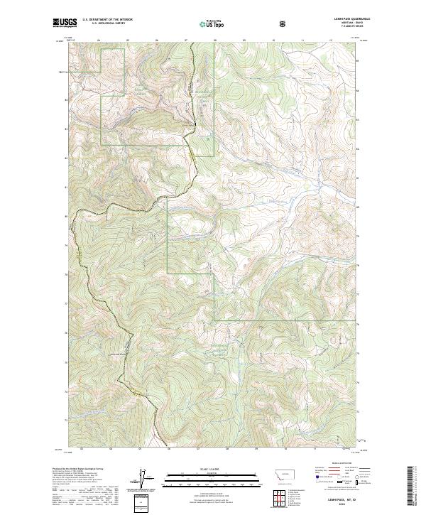
2024 Map of Lemhi Pass
USGS Topo · Published 2024About this map
Lemhi Pass marks a critical point on the Continental Divide, where the border between Idaho and Montana follows the crest of the Bitterroot Range. This high-altitude landscape is defined by the convergence of the Salmon National Forest and Beaverhead National Forest, preserving the rugged corridors used by early expeditions. The modern topographic data highlights the intersection of the Lewis And Clark Nht Trl and the Continental Divide National Scenic Trl, tracing the same ridgelines and drainages known to historical travelers. Numerous watercourses radiate from the divide, including the headwaters of Agency Creek flowing westward and Trail Creek and Frying Pan Creek descending to the east. Remote features like Distant Fountain and the Mine Spr reflect the specialized needs of travelers and laborers in this wilderness terrain.
Find a feature on this map
36 named features on this map. Tap any name to fly to it.
Don’t see what you’re looking for? This feature index may not catch every label — zoom into the map to look around manually.
Map Details
Editions of this 2024 Lemhi Pass Map
This is the sole edition of this map. No revisions or reprints were ever made.
Other maps of this area

1955 · Dubois
USGS Topo · 1:250,000

1955 · Dillon
USGS Topo · 1:250,000

1956 · Goldstone Mtn
USGS Topo · 1:62,500

1956 · Lemhi
USGS Topo · 1:62,500

1957 · Dillon
USGS Topo · 1:250,000

1958 · Dubois
USGS Topo · 1:250,000

1958 · Dillon
USGS Topo · 1:250,000

1962 · Dillon
USGS Topo · 1:250,000

1965 · Dillon
USGS Topo · 1:250,000

1965 · Lemhi Pass
USGS Topo · 1:24,000