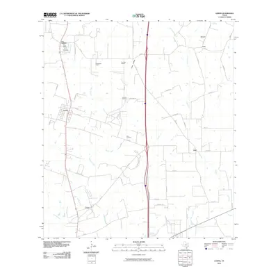
2010 Map of Leming
USGS Topo · Published 2010About this map
Las Gallinas and Leming anchor the western reaches of this Atascosa County landscape, where the rural character of South Texas remains prominently displayed at the start of the twenty-first century. The map reveals a dense network of family-named roads and landmarks, such as Korus Farmstead and the Longs Farm Airport, reflecting a lineage of land ownership that defines the local geography. Significant for genealogical research, the sheet identifies several remote burial grounds including Saint Joseph Cemetery, Tuminson Cemetery, and Brite Cemetery, often tucked away near the intermittent drainages of Gallinas Creek and Positeus Creek.
Find a feature on this map
59 named features on this map. Tap any name to fly to it.
Don’t see what you’re looking for? This feature index may not catch every label — zoom into the map to look around manually.
Map Details
Editions of this 2010 Leming Map
This is the sole edition of this map. No revisions or reprints were ever made.
Other maps of this area

1953 · Crystal City
USGS Topo · 1:250,000

1954 · San Antonio
USGS Topo · 1:250,000

1955 · Crystal City
USGS Topo · 1:250,000

1956 · Pleasanton
USGS Topo · 1:62,500

1956 · Jourdanton
USGS Topo · 1:62,500

1957 · San Antonio
USGS Topo · 1:250,000

1958 · Losoya
USGS Topo · 1:24,000

1958 · Thelma
USGS Topo · 1:24,000

1958 · Saspamco
USGS Topo · 1:24,000

1961 · Crystal City
USGS Topo · 1:250,000