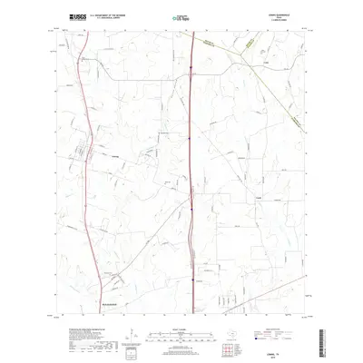
2019 Map of Leming
USGS Topo · Published 2019About this map
Leming sits at the heart of this Atascosa County landscape, where the northern coastal plains begin to ripple with the drainage networks of the Atascosa River. The map highlights a series of small agricultural and rural communities including Verdi and Loire, the latter positioned near the convergence of the Bexar, Wilson, and Atascosa county lines. This region is characterized by its numerous small burial grounds that serve as vital markers for local family histories, such as Saint Joseph Cem, Tumlinson Cem, and Rodriguez Cem. The drainage patterns of Gallinas Cr and Lucas Cr define the local topography, influencing the placement of early farm roads and modern thoroughfares. To the south, the expansion of Pleasanton is visible, showing the shift from rural acreage to organized street grids like 2nd St and Encino Village Dr.
Find a feature on this map
90 named features on this map. Tap any name to fly to it.
Don’t see what you’re looking for? This feature index may not catch every label — zoom into the map to look around manually.
Map Details
Editions of this 2019 Leming Map
This is the sole edition of this map. No revisions or reprints were ever made.
Other maps of this area

1953 · Crystal City
USGS Topo · 1:250,000

1954 · San Antonio
USGS Topo · 1:250,000

1955 · Crystal City
USGS Topo · 1:250,000

1956 · Pleasanton
USGS Topo · 1:62,500

1956 · Jourdanton
USGS Topo · 1:62,500

1957 · San Antonio
USGS Topo · 1:250,000

1958 · Losoya
USGS Topo · 1:24,000

1958 · Thelma
USGS Topo · 1:24,000

1958 · Saspamco
USGS Topo · 1:24,000

1961 · Crystal City
USGS Topo · 1:250,000