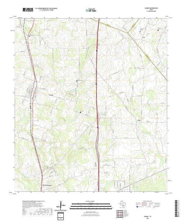
2022 Map of Leming
USGS Topo · Published 2022About this map
Pleasanton and the surrounding rural communities of Atascosa County are captured here in the early 2020s, revealing a landscape defined by ranching roads and a network of creeks. The area is notable for its concentration of family and community burial grounds, including Saint Joseph Cem near the northern boundary and San Augustin Cem to the south. These landmarks, along with Brite Cem and Tumlinson Cem, offer significant reference points for local genealogy. The terrain is drained by numerous waterways such as Gallinas Cr and Galvan Cr, which eventually lead toward the Atascosa River. Distinctive local names like Purtle Hollow and Doodle Bug Ln reflect the personal history of the settlements at Leming, Verdi, and Loire.
Find a feature on this map
100 named features on this map. Tap any name to fly to it.
Don’t see what you’re looking for? This feature index may not catch every label — zoom into the map to look around manually.
Map Details
Editions of this 2022 Leming Map
This is the sole edition of this map. No revisions or reprints were ever made.
Other maps of this area

1953 · Crystal City
USGS Topo · 1:250,000

1954 · San Antonio
USGS Topo · 1:250,000

1955 · Crystal City
USGS Topo · 1:250,000

1956 · Pleasanton
USGS Topo · 1:62,500

1956 · Jourdanton
USGS Topo · 1:62,500

1957 · San Antonio
USGS Topo · 1:250,000

1958 · Losoya
USGS Topo · 1:24,000

1958 · Thelma
USGS Topo · 1:24,000

1958 · Saspamco
USGS Topo · 1:24,000

1961 · Crystal City
USGS Topo · 1:250,000