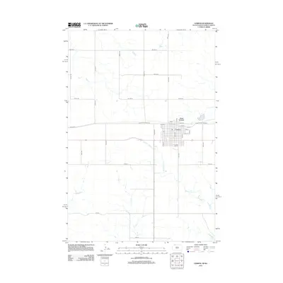
2012 Map of Lemmon
USGS Topo · Published 2012About this map
The city of Lemmon sits at the northern edge of South Dakota, where the S Dakota State Railroad runs along the border and transitions into North Lemmon across the state line. The town's grid is well-defined by central arteries such as Main Ave and Theatre Rd, serving as a regional hub in this agricultural landscape. On the southern edge of the settlement lies Green Hill Cem, providing a focal point for genealogical research in this part of Perkins County. Beyond the residential and commercial center, the terrain is shaped by the intermittent flow of Thunder Hawk Cr and E Flat Cr. These watercourses carve through the surrounding plains, which are neatly divided by a network of rural roads like 189th Ave and 104th St, reflecting the persistent section-line development that characterizes the Dakotas.
Find a feature on this map
35 named features on this map. Tap any name to fly to it.
Don’t see what you’re looking for? This feature index may not catch every label — zoom into the map to look around manually.
Map Details
Editions of this 2012 Lemmon Map
This is the sole edition of this map. No revisions or reprints were ever made.
Other maps of this area

1953 · Dickinson
USGS Topo · 1:250,000

1954 · Lemmon
USGS Topo · 1:250,000

1957 · Dickinson
USGS Topo · 1:250,000

1957 · Lemmon
USGS Topo · 1:250,000
1974 · Nason Hill
USGS Topo · 1:24,000

1974 · Cedar Butte
USGS Topo · 1:24,000

1974 · White Butte
USGS Topo · 1:24,000

1974 · Lemmon
USGS Topo · 1:24,000
1974 · Lemmon NE
USGS Topo · 1:24,000

1980 · Mott
USGS Topo · 1:100,000