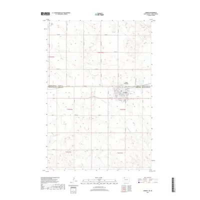
2017 Map of Lemmon
USGS Topo · Published 2017About this map
Lemmon sits at the northern edge of Perkins County, anchored by a tight street grid that straddles the state line into North Lemmon, North Dakota. This 2017 survey reveals the distinct land management patterns along the border, where the South Dakota side is characterized by named rural corridors such as Watman Rd and Theater Rd. The landscape is defined by the drainage of Thunder Hawk Cr and E Flat Cr, which carve through the undulating terrain south of the town center.
Find a feature on this map
53 named features on this map. Tap any name to fly to it.
Don’t see what you’re looking for? This feature index may not catch every label — zoom into the map to look around manually.
Map Details
Editions of this 2017 Lemmon Map
This is the sole edition of this map. No revisions or reprints were ever made.
Other maps of this area

1953 · Dickinson
USGS Topo · 1:250,000

1954 · Lemmon
USGS Topo · 1:250,000

1957 · Dickinson
USGS Topo · 1:250,000

1957 · Lemmon
USGS Topo · 1:250,000
1974 · Nason Hill
USGS Topo · 1:24,000

1974 · Cedar Butte
USGS Topo · 1:24,000

1974 · White Butte
USGS Topo · 1:24,000

1974 · Lemmon
USGS Topo · 1:24,000
1974 · Lemmon NE
USGS Topo · 1:24,000

1980 · Mott
USGS Topo · 1:100,000