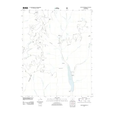
2011 Map of Lemon Reservoir
USGS Topo · Published 2011About this map
Lemon Reservoir dominates the eastern drainage of Missionary Ridge, formed by the construction of Lemon Dam across the Florida River. This high-altitude landscape is defined by a series of named parks and canyons that reflect the historical grazing and transit patterns of the region, including Big Bear Park, Horse Park, and the descriptively named Horse Thief Park. High points like Silver Pass and Miller Mountain frame the watershed, where numerous tributaries such as Waldner Creek and Blodgett Creek feed into the central reservoir. The area is heavily marked by recreational and forest infrastructure, shown through established sites like Transfer Park Campground and Bear Creek Campground. The map also captures the rugged drainage systems of McClure Canyon and Youngs Canyon, illustrating the complex topography east of the ridge line.
Find a feature on this map
56 named features on this map. Tap any name to fly to it.
Don’t see what you’re looking for? This feature index may not catch every label — zoom into the map to look around manually.
Map Details
Editions of this 2011 Lemon Reservoir Map
This is the sole edition of this map. No revisions or reprints were ever made.
Other maps of this area

1898 · Durango
USGS Topo · 1:62,500

1898 · Engineer Mountain
USGS Topo · 1:62,500

1900 · Engineer Mountain
USGS Topo · 1:62,500

1900 · Needle Mountains
USGS Topo · 1:62,500

1902 · Needle Mountains
USGS Topo · 1:62,500

1907 · Durango
USGS Topo · 1:62,500

1908 · Engineer Mountain
USGS Topo · 1:62,500

1908 · Ignacio
USGS Topo · 1:125,000

1908 · Durango
USGS Topo · 1:62,500

1924 · Ignacio
USGS Topo · 1:125,000