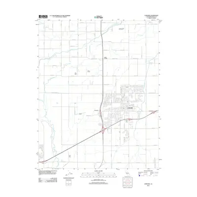
2012 Map of Lemoore
USGS Topo · Published 2012About this map
Agricultural operations and water management systems define this portion of Kings County, where the city of Lemoore serves as the central hub. The landscape is an intricate grid of rural roads and irrigation features, including the Lemoore Canal and the West Branch Last Chance Ditch, which support the surrounding dairy and ranching lands. Named holdings such as the Tony Martin Dairy and South Fork Ranch are situated near the wandering path of the Kings River and its various forks, including the Clarks Fork Kings River and South Fork Kings River. Small outlying settlements like Halls Corner, Cimarron, and Rossi dot the intersections of long avenues. Notable local landmarks include the Lemoore Cem and aviation facilities like the Vineyard Oaks Farm Airport and Stone Airstrip, reflecting the region's combined focus on municipal growth and large-scale farming.
Find a feature on this map
40 named features on this map. Tap any name to fly to it.
Don’t see what you’re looking for? This feature index may not catch every label — zoom into the map to look around manually.
Map Details
Editions of this 2012 Lemoore Map
This is the sole edition of this map. No revisions or reprints were ever made.
Other maps of this area

1924 · Riverdale
USGS Topo · 1:31,680

1926 · Hanford
USGS Topo · 1:31,680

1926 · Lethent
USGS Topo · 1:31,680

1927 · Laton
USGS Topo · 1:31,680

1927 · Burrel
USGS Topo · 1:31,680

1927 · Riverdale
USGS Topo · 1:31,680

1927 · Lemoore
USGS Topo · 1:31,680

1929 · Guernsey
USGS Topo · 1:31,680

1929 · Stratford
USGS Topo · 1:31,680

1929 · Westhaven
USGS Topo · 1:31,680