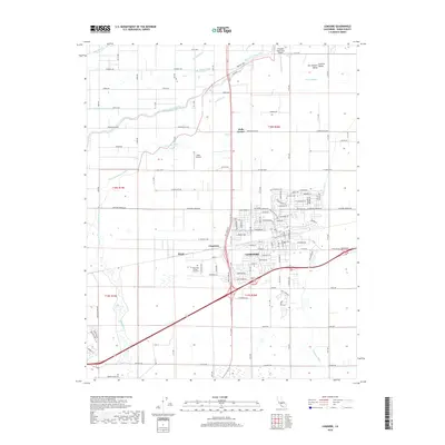
2018 Map of Lemoore
USGS Topo · Published 2018About this map
Lemoore and the surrounding agricultural landscape of the Central Valley are defined by an intricate network of waterways and irrigation infrastructure. The South Fork Kings River winds through the northern and western portions of the area, complemented by features such as Crooked Slough, Green Slough, and the Lemoore Canal. This environment supports a mix of small settlements and transportation hubs, including Halls Corner, Cimarron, and Rossi. Notable local institutions and landmarks such as West Hills College - Lemoore, the Lemoore Cem, and private aviation sites like Stone Airstrip and the Vineyard Oaks Farm Airport illustrate the modern development of this Kings County region. The grid-like road system, featuring Grangeville Blvd and Hanford Armona Rd, serves as the framework for the area's ongoing connection to its water-driven economy.
Find a feature on this map
85 named features on this map. Tap any name to fly to it.
Don’t see what you’re looking for? This feature index may not catch every label — zoom into the map to look around manually.
Map Details
Editions of this 2018 Lemoore Map
This is the sole edition of this map. No revisions or reprints were ever made.
Other maps of this area

1924 · Riverdale
USGS Topo · 1:31,680

1926 · Hanford
USGS Topo · 1:31,680

1926 · Lethent
USGS Topo · 1:31,680

1927 · Laton
USGS Topo · 1:31,680

1927 · Burrel
USGS Topo · 1:31,680

1927 · Riverdale
USGS Topo · 1:31,680

1927 · Lemoore
USGS Topo · 1:31,680

1929 · Guernsey
USGS Topo · 1:31,680

1929 · Stratford
USGS Topo · 1:31,680

1929 · Westhaven
USGS Topo · 1:31,680