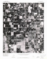
1976 Map of Lemoore
USGS Topo · Published 1980About this map
Lemoore stands as a dense grid of residential and commercial development surrounded by the precise geometry of Central Valley agriculture in this mid-1970s orthophotoquad. Unlike traditional topographic maps, this aerial perspective reveals the actual textures of the landscape, from the dark, rectangular patches of irrigated fields to the winding, tree-lined riparian corridors of the North Fork Kings River and Clarks Fork. The contrast between the rigid human-imposed order of the orchards and the fluid, organic paths of the river system highlights the intensive land management required in this part of Kings County. For researchers, this imagery provides a literal view of the road networks, farmstead footprints, and the growing urban edges of the community as they existed decades ago.
Find a feature on this map
3 named features on this map. Tap any name to fly to it.
Don’t see what you’re looking for? This feature index may not catch every label — zoom into the map to look around manually.
Map Details
Editions of this 1976 Lemoore Map
This is the sole edition of this map. No revisions or reprints were ever made.
Other maps of this area

1924 · Riverdale
USGS Topo · 1:31,680

1926 · Hanford
USGS Topo · 1:31,680

1926 · Lethent
USGS Topo · 1:31,680

1927 · Laton
USGS Topo · 1:31,680

1927 · Burrel
USGS Topo · 1:31,680

1927 · Riverdale
USGS Topo · 1:31,680

1927 · Lemoore
USGS Topo · 1:31,680

1929 · Guernsey
USGS Topo · 1:31,680

1929 · Stratford
USGS Topo · 1:31,680

1929 · Westhaven
USGS Topo · 1:31,680