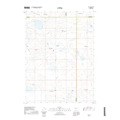
2017 Map of Lena
USGS Topo · Published 2017About this map
The high plains of western Nebraska converge at the border of Grant, Arthur, Hooker, and McPherson counties, revealing a landscape defined by seasonal wetlands and isolated valleys. The small settlements of Lena and Calora serve as central points in this remote cattle-ranching country, connected by a network of rural routes including Whitman Rd and Rothwell Rd. The geography is characterized by distinct topographical depressions known locally as valleys, such as Mill Camp Valley, Bassett Valley, and Eleven Valley, many of which harbor vital water sources like Swan Lake and Threemile Lake. These water bodies are essential features in the Sandhills region, where landmarks like Baldy Hill rise above the surrounding terrain. This survey provides a precise view of the early 21st-century property divisions and land use in a region where the vastness of the prairie is punctuated by specific, named family landmarks and vital watering holes.
Find a feature on this map
31 named features on this map. Tap any name to fly to it.
Don’t see what you’re looking for? This feature index may not catch every label — zoom into the map to look around manually.
Map Details
Editions of this 2017 Lena Map
This is the sole edition of this map. No revisions or reprints were ever made.
Other maps of this area

1948 · Carr Lake
USGS Topo · 1:62,500

1948 · Spring Valley
USGS Topo · 1:62,500

1949 · Arthur
USGS Topo · 1:62,500

1949 · Flats
USGS Topo · 1:62,500

1950 · Flats
USGS Topo · 1:62,500

1950 · Spring Valley
USGS Topo · 1:62,500

1950 · Carr Lake
USGS Topo · 1:62,500

1950 · Arthur
USGS Topo · 1:62,500

1954 · North Platte
USGS Topo · 1:250,000

1956 · North Platte
USGS Topo · 1:250,000