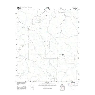
2012 Map of Lena
USGS Topo · Published 2012About this map
Lena and its surrounding rural communities are presented in this early 21st-century landscape, where a dense network of country roads connects family settlements and local landmarks. The area's history is preserved in its numerous burial grounds, including the centrally located Lena Cem and the more remote Harmony Cem and Cash Cem. The landscape is defined by the winding paths of Balucta Creek and Slay Creek, which drain the lowlands between named points like Island Hill. Traces of former transport infrastructure are visible at Sproles Siding, reflecting the area's logistical past. Small hamlets such as Cash, Abdan, and Midway serve as focal points for the scattered homesteads, while Dumas Pond provides a prominent water feature near the center of the region. The map reveals a high concentration of cemeteries, such as Pilgrim Rest Cem and Trinity Cem, which offer significant value for genealogical research in this part of Mississippi.
Find a feature on this map
91 named features on this map. Tap any name to fly to it.
Don’t see what you’re looking for? This feature index may not catch every label — zoom into the map to look around manually.
Map Details
Editions of this 2012 Lena Map
This is the sole edition of this map. No revisions or reprints were ever made.
Other maps of this area

1921 · Forest
USGS Topo · 1:48,000

1922 · Forest
USGS Topo · 1:62,500

1922 · Morton
USGS Topo · 1:48,000

1924 · Morton
USGS Topo · 1:62,500

1950 · Forest
USGS Topo · 1:62,500

1951 · Morton
USGS Topo · 1:62,500

1952 · Forest
USGS Topo · 1:62,500

1953 · Meridian
USGS Topo · 1:250,000

1957 · Meridian
USGS Topo · 1:250,000

1961 · Carthage
USGS Topo · 1:62,500