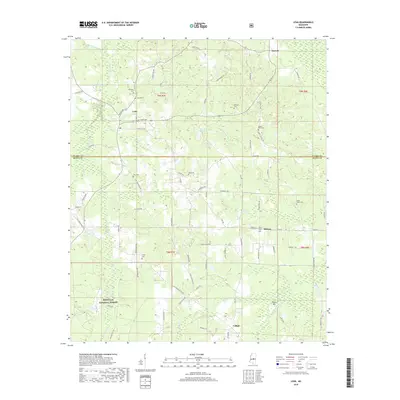
2018 Map of Lena
USGS Topo · Published 2018About this map
Lena stands at a central junction in Leake County, where the landscape is defined by a dense network of country roads and timbered reaches within the Bienville National Forest. The map documents a predominantly rural geography where small communities like Tuscola, Midway, and Lillian are connected by a web of routes including Grand Ave, Lena-Walnut Grove Rd, and Lena Cash Rd. Numerous family and community landmarks are recorded, such as Robinson Cem, Pilgrim Rest Cem, and the Harmony Cem near Trinity Cem. The topography is shaped by the winding courses of Sweetwater Cr and Shockaloo Cr, while prominent local elevations like Island Hill rise above the surrounding creek bottoms and pine stands. This 2018 survey provides a clear view of the modern road system imposed over the traditional settlement patterns of central Mississippi.
Find a feature on this map
83 named features on this map. Tap any name to fly to it.
Don’t see what you’re looking for? This feature index may not catch every label — zoom into the map to look around manually.
Map Details
Editions of this 2018 Lena Map
This is the sole edition of this map. No revisions or reprints were ever made.
Other maps of this area

1921 · Forest
USGS Topo · 1:48,000

1922 · Forest
USGS Topo · 1:62,500

1922 · Morton
USGS Topo · 1:48,000

1924 · Morton
USGS Topo · 1:62,500

1950 · Forest
USGS Topo · 1:62,500

1951 · Morton
USGS Topo · 1:62,500

1952 · Forest
USGS Topo · 1:62,500

1953 · Meridian
USGS Topo · 1:250,000

1957 · Meridian
USGS Topo · 1:250,000

1961 · Carthage
USGS Topo · 1:62,500