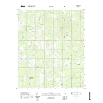
2021 Map of Lena
USGS Topo · Published 2021About this map
Lena stands as the central hub of this Mississippi landscape, situated at the junction of Grand Ave and Lena-Walnut Grove Rd. The area is defined by a dense network of family-named cemeteries such as Harmony Cem, Lena Cem, and Robinson Cem, which offer significant genealogical value for those tracing local lineages. To the south, the boundary of the Bienville National Forest marks a shift from small-scale agricultural holdings to protected woodlands. Waterways like Balucta Cr and Sweetwater Cr drain the terrain, which is dotted with rural settlements including Tuscola to the north and Midway to the east. The map captures a contemporary snapshot of a traditional Southern landscape where community identity remains tied to longstanding local roads like Union Ridge Rd and Rabbit College Rd.
Find a feature on this map
86 named features on this map. Tap any name to fly to it.
Don’t see what you’re looking for? This feature index may not catch every label — zoom into the map to look around manually.
Map Details
Editions of this 2021 Lena Map
This is the sole edition of this map. No revisions or reprints were ever made.
Other maps of this area

1921 · Forest
USGS Topo · 1:48,000

1922 · Forest
USGS Topo · 1:62,500

1922 · Morton
USGS Topo · 1:48,000

1924 · Morton
USGS Topo · 1:62,500

1950 · Forest
USGS Topo · 1:62,500

1951 · Morton
USGS Topo · 1:62,500

1952 · Forest
USGS Topo · 1:62,500

1953 · Meridian
USGS Topo · 1:250,000

1957 · Meridian
USGS Topo · 1:250,000

1961 · Carthage
USGS Topo · 1:62,500