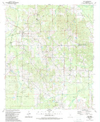
1989 Map of Lena
USGS Topo · Published 1989About this map
The Bienville National Forest dominates the southern landscape of this 1989 edition, which documents the boundary between Leake and Scott counties. Settlement in this region is defined by small communities such as Lena and Tuscola, which developed alongside the Railroad and various timber or agriculture-based sidings. Evidence of the early 20th-century logging era is preserved in labels like Sproles Siding and an Old Grade, tracing former transport routes through the creek bottoms.
Find a feature on this map
42 named features on this map. Tap any name to fly to it.
Don’t see what you’re looking for? This feature index may not catch every label — zoom into the map to look around manually.
Map Details
Editions of this 1989 Lena Map
This is the sole edition of this map. No revisions or reprints were ever made.
Other maps of this area

1921 · Forest
USGS Topo · 1:48,000

1922 · Forest
USGS Topo · 1:62,500

1922 · Morton
USGS Topo · 1:48,000

1924 · Morton
USGS Topo · 1:62,500

1950 · Forest
USGS Topo · 1:62,500

1951 · Morton
USGS Topo · 1:62,500

1952 · Forest
USGS Topo · 1:62,500

1953 · Meridian
USGS Topo · 1:250,000

1957 · Meridian
USGS Topo · 1:250,000

1961 · Carthage
USGS Topo · 1:62,500