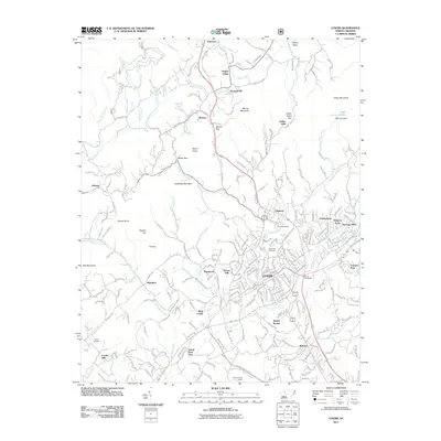
2011 Map of Lenoir
USGS Topo · Published 2011About this map
Lenoir serves as the focal point of this region, surrounded by a dense network of suburban developments and established neighborhoods including Whitnel, Valmead, and British Woods. The landscape transitions from the urbanized valley floor to the prominent peaks of the Blue Ridge foothills, such as Warrior Mountain and Green Mountain. In the northern reaches, the Yadkin River flows through the scenic Happy Valley near Patterson, an area defined by its riparian corridor and agricultural character. Cultural landmarks are scattered throughout the map, ranging from historical burial grounds like Puette Cemetery and Belleview Cemetery to industrial sites like the Causby Gneiss Quarry near Millers Creek. The intersection of nature and infrastructure is evident in the development of High Lake Dam and the various gaps like Setzer Gap and Warrior Gap that have long facilitated movement through this complex terrain.
Find a feature on this map
243 named features on this map. Tap any name to fly to it.
Don’t see what you’re looking for? This feature index may not catch every label — zoom into the map to look around manually.
Map Details
Editions of this 2011 Lenoir Map
This is the sole edition of this map. No revisions or reprints were ever made.
Other maps of this area

1889 · Wilkesboro
USGS Topo · 1:125,000

1891 · Wilkesboro
USGS Topo · 1:125,000

1893 · Cranberry
USGS Topo · 1:125,000

1895 · Hickory
USGS Topo · 1:125,000

1895 · Cranberry
USGS Topo · 1:125,000

1899 · Cranberry
USGS Topo · 1:125,000

1902 · Cranberry
USGS Topo · 1:125,000

1905 · Morganton
USGS Topo · 1:125,000

1936 · Blowing Rock
USGS Topo · 1:48,000

1942 · Blowing Rock
USGS Topo · 1:62,500