2022 Map of Lenoir
USGS Topo · Published 2022About this map
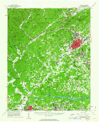
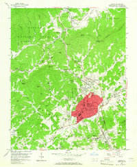
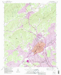
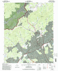
Lenoir serves as the focal point of this survey, anchored by the Caldwell County Courthouse as the area transitions from the urban center into the foothills of the Pisgah National Forest. The landscape is defined by the descending waters of the Yadkin River in the north and the complex drainage of Lower Creek and Blair Fork through the residential and commercial corridors. Settled pockets like Happy Valley and Warrior sit along the major routes leading toward the gaps, while the southern reaches show the developed sprawl toward Whitnel and Gamewell. Genealogists will find significant detail in the placement of local burial grounds such as Bellview Cem, Clark Cem, and Puette Cem, which are situated among a network of family-named landmarks and mountain gaps that have historically dictated the movement of people and commerce through the county.
Find a feature on this map
229 named features on this map. Tap any name to fly to it.
Don’t see what you’re looking for? This feature index may not catch every label — zoom into the map to look around manually.
Map Details
Editions of this 2022 Lenoir Map
This is the sole edition of this map. No revisions or reprints were ever made.
Historical Maps of Valmead Through Time
5 maps found