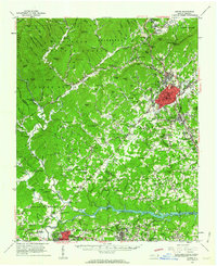
1956 Map of Lenoir
USGS Topo · Published 1963About this map
The Pisgah National Forest dominates the northwestern landscape of this mid-century survey, where the Johns River and Wilson Creek carve through a terrain of named ridges like Grassy Ridge and Larkin Ridge. The industrial and residential center of Lenoir sits at the eastern edge, showing the Southern Railway corridor connecting the town to Hudson and Whitnel. Along the southern border, the Catawba River expands into Rhodhiss Lake, providing a focal point for settlements like Drexel, Valdese, and the county seat at Morganton.
Find a feature on this map
149 named features on this map. Tap any name to fly to it.
Don’t see what you’re looking for? This feature index may not catch every label — zoom into the map to look around manually.
Map Details
Editions of this 1956 Lenoir Map
This is the sole edition of this map. No revisions or reprints were ever made.
Other maps of this area

1889 · Wilkesboro
USGS Topo · 1:125,000

1891 · Wilkesboro
USGS Topo · 1:125,000

1893 · Cranberry
USGS Topo · 1:125,000

1895 · Hickory
USGS Topo · 1:125,000

1895 · Cranberry
USGS Topo · 1:125,000

1899 · Cranberry
USGS Topo · 1:125,000

1902 · Cranberry
USGS Topo · 1:125,000
1905 · Morganton
USGS Topo · 1:125,000
1936 · Blowing Rock
USGS Topo · 1:48,000
1942 · Blowing Rock
USGS Topo · 1:62,500