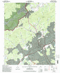
1994 Map of Lenoir
USGS Topo · Published 1998About this map
The Yadkin River and its numerous tributaries, including Setzer Creek and Blair Fork, carve through the foothills north of Lenoir in this mid-1990s perspective. The landscape transitions from the protected woodland of the Pisgah National Forest and heights like Warrior Mtn to the dense residential and industrial corridors of Whitnel, Valmead, and Gamewell. Local social infrastructure is prominent, with numerous neighborhood landmarks such as Caldwell Memorial Hospital, Hood Chapel, and the Bushtown Sch anchoring small communities outside the city center.
Find a feature on this map
73 named features on this map. Tap any name to fly to it.
Don’t see what you’re looking for? This feature index may not catch every label — zoom into the map to look around manually.
Map Details
Editions of this 1994 Lenoir Map
This is the sole edition of this map. No revisions or reprints were ever made.
Other maps of this area

1889 · Wilkesboro
USGS Topo · 1:125,000

1891 · Wilkesboro
USGS Topo · 1:125,000

1893 · Cranberry
USGS Topo · 1:125,000

1895 · Hickory
USGS Topo · 1:125,000

1895 · Cranberry
USGS Topo · 1:125,000

1899 · Cranberry
USGS Topo · 1:125,000

1902 · Cranberry
USGS Topo · 1:125,000

1905 · Morganton
USGS Topo · 1:125,000

1936 · Blowing Rock
USGS Topo · 1:48,000

1942 · Blowing Rock
USGS Topo · 1:62,500