
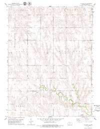
1978 Map of Lenora East
USGS Topo · Published 1979About this map
Lenora stands on the western edge of this northwest Kansas landscape, situated where the Missouri Pacific railroad corridor meets the valley of the North Fork Solomon River. This late-1970s survey captures the area's transition from the river bottomlands to the dissected plains of Indiana and Modell townships. The local geography is defined by the winding paths of Bow Creek, East Elk Cr, and Lost Creek, which cut through the terrain south of the Norton and Graham County line. Local landmarks include the County Park and Lake with its Golf Course and the Larrick Park area, while industrial and municipal sites like a Sandpit, Quarry, and Pumping Station indicate the region's managed resources. For genealogists, the map identifies the Modell Cem and a second Cem near the town center.
Find a feature on this map
21 named features on this map. Tap any name to fly to it.
Don’t see what you’re looking for? This feature index may not catch every label — zoom into the map to look around manually.
Map Details
Editions of this 1978 Lenora East Map
This is the sole edition of this map. No revisions or reprints were ever made.
Other maps of this area

1893 · Norton
USGS Topo · 1:125,000

1893 · Hill
USGS Topo · 1:125,000

1954 · Goodland
USGS Topo · 1:250,000

1955 · Beloit
USGS Topo · 1:250,000

1956 · Goodland
USGS Topo · 1:250,000

1957 · Goodland
USGS Topo · 1:250,000

1959 · Beloit
USGS Topo · 1:250,000

1978 · Edmond
USGS Topo · 1:24,000

1978 · Lenora West
USGS Topo · 1:24,000
1978 · Clayton NE
USGS Topo · 1:24,000