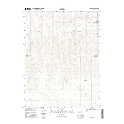
2015 Map of Lenora West
USGS Topo · Published 2015About this map
The N Fork Solomon River meanders across this rural section of northwest Kansas, dividing the northern plains of Norton County from the higher ground of Graham County. The town of Lenora serves as the primary hub, where local life centers around W Washington Ave and the Lenora Municipal Airport. To the west, the community of New Almelo sits near the riverbanks, anchored by the Saint Joseph Cem. The landscape is defined by a dense network of sectional roads, including Rd BB and S Lenora Rd, which navigate the drainages of Marsh Cr, Coon Cr, and Lost Cr. This 2015 survey illustrates a contemporary agricultural region where historical cemetery sites like Lenora South Cem remain vital landmarks of the local heritage and settlement pattern.
Find a feature on this map
31 named features on this map. Tap any name to fly to it.
Don’t see what you’re looking for? This feature index may not catch every label — zoom into the map to look around manually.
Map Details
Editions of this 2015 Lenora West Map
This is the sole edition of this map. No revisions or reprints were ever made.
Other maps of this area

1893 · Norton
USGS Topo · 1:125,000

1893 · Hill
USGS Topo · 1:125,000

1954 · Goodland
USGS Topo · 1:250,000

1955 · Beloit
USGS Topo · 1:250,000

1956 · Goodland
USGS Topo · 1:250,000

1957 · Goodland
USGS Topo · 1:250,000

1959 · Beloit
USGS Topo · 1:250,000

1978 · Clayton SW
USGS Topo · 1:24,000

1978 · Clayton
USGS Topo · 1:24,000

1978 · Lenora East
USGS Topo · 1:24,000