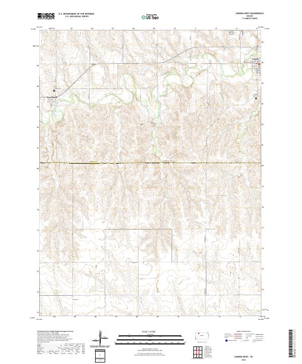
2022 Map of Lenora West
USGS Topo · Published 2022About this map
The N Fork Solomon River meanders across this Northwest Kansas landscape, carving a valley that separates the rolling plains of t5s r25w and t5s r24w. This 2022 survey captures a distinct rural settlement pattern where the village of New Almelo sits near the western edge, defined by its proximity to the Saint Joseph Cem. To the east, the town of Lenora serves as a local hub, featuring a traditional street grid with names like W Washington Ave and S Main St. The terrain is deeply dissected by numerous tributaries, including Coon Cr, Marsh Cr, and Lost Cr, which flow northward toward the main river valley. This modern data highlights the enduring nature of these agricultural communities and their essential infrastructure, from the Lenora Municipal Airport to the Lenora South Cem located just outside the town limits.
Find a feature on this map
32 named features on this map. Tap any name to fly to it.
Don’t see what you’re looking for? This feature index may not catch every label — zoom into the map to look around manually.
Map Details
Editions of this 2022 Lenora West Map
This is the sole edition of this map. No revisions or reprints were ever made.
Other maps of this area

1893 · Norton
USGS Topo · 1:125,000

1893 · Hill
USGS Topo · 1:125,000

1954 · Goodland
USGS Topo · 1:250,000

1955 · Beloit
USGS Topo · 1:250,000

1956 · Goodland
USGS Topo · 1:250,000

1957 · Goodland
USGS Topo · 1:250,000

1959 · Beloit
USGS Topo · 1:250,000

1978 · Clayton SW
USGS Topo · 1:24,000

1978 · Clayton
USGS Topo · 1:24,000

1978 · Lenora East
USGS Topo · 1:24,000