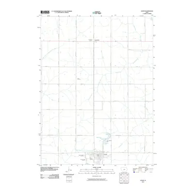
2010 Map of Lenox
USGS Topo · Published 2010About this map
The agrarian landscape of Taylor County is anchored by the community of Lenox, located at the southern edge of this survey. The town serves as a local hub, featuring the Lenox Post Office and a cluster of burial grounds including North Fairview Cemetery, East Fairview Cemetery, and West Fairview Cemetery. North of the main settlement, the terrain is characterized by a grid of rural roads and the meandering paths of the Middle Branch One Hundred and Two River and the West Branch One Hundred and Two River.
Find a feature on this map
43 named features on this map. Tap any name to fly to it.
Don’t see what you’re looking for? This feature index may not catch every label — zoom into the map to look around manually.
Map Details
Editions of this 2010 Lenox Map
This is the sole edition of this map. No revisions or reprints were ever made.
Other maps of this area

1954 · Omaha
USGS Topo · 1:250,000

1955 · Nebraska City
USGS Topo · 1:250,000

1957 · Nebraska City
USGS Topo · 1:250,000

1957 · Omaha
USGS Topo · 1:250,000

1958 · Omaha
USGS Topo · 1:250,000

1958 · Nebraska City
USGS Topo · 1:250,000

1980 · Corning South
USGS Topo · 1:24,000

1980 · Gravity
USGS Topo · 1:24,000

1980 · Merle Junction
USGS Topo · 1:24,000

1980 · Lenox
USGS Topo · 1:24,000