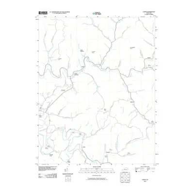
2010 Map of Lenox
USGS Topo · Published 2010About this map
Elk Fork and its winding tributaries dominate this portion of Morgan County, where small rural communities like Lenox and Elkfork are situated along the valley floors. The landscape is defined by the heavy dissection of the Cumberland Plateau, with prominent elevations such as Limekiln Knob and Bolin Ridge separating the various creek drainages. Significant family history is preserved throughout the quadrangle in the form of numerous small burial grounds, including the Adkins Cemetery and Patton Cemetery.
Find a feature on this map
81 named features on this map. Tap any name to fly to it.
Don’t see what you’re looking for? This feature index may not catch every label — zoom into the map to look around manually.
Map Details
Editions of this 2010 Lenox Map
This is the sole edition of this map. No revisions or reprints were ever made.
Other maps of this area

1889 · Salyersville
USGS Topo · 1:125,000

1891 · Salyersville
USGS Topo · 1:125,000

1899 · Salyersville
USGS Topo · 1:125,000

1929 · Morehead
USGS Topo · 1:48,000

1935 · Morehead
USGS Topo · 1:62,500

1950 · Isonville
USGS Topo · 1:24,000

1950 · Sandy Hook
USGS Topo · 1:24,000

1950 · Lenox
USGS Topo · 1:24,000

1951 · Cannel City
USGS Topo · 1:24,000

1951 · White Oak
USGS Topo · 1:24,000