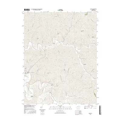
2016 Map of Lenox
USGS Topo · Published 2016About this map
Lenox serves as a central point in this part of Morgan County, where the terrain is defined by a dense network of ridges and hollows. The landscape is marked by prominent elevations such as Limekiln Knob, Granddaddy Knob, and Fairfield Hill, which rise above the winding creek beds and narrow valleys that dictate the local road patterns. The drainage system is particularly intricate, featuring named waterways like Cow Branch, Lacy Creek, and Spaws Creek, illustrating the deep topographical carving characteristic of the Cumberland Plateau's eastern reaches.
Find a feature on this map
60 named features on this map. Tap any name to fly to it.
Don’t see what you’re looking for? This feature index may not catch every label — zoom into the map to look around manually.
Map Details
Editions of this 2016 Lenox Map
This is the sole edition of this map. No revisions or reprints were ever made.
Other maps of this area

1889 · Salyersville
USGS Topo · 1:125,000

1891 · Salyersville
USGS Topo · 1:125,000

1899 · Salyersville
USGS Topo · 1:125,000

1929 · Morehead
USGS Topo · 1:48,000

1935 · Morehead
USGS Topo · 1:62,500

1950 · Isonville
USGS Topo · 1:24,000

1950 · Sandy Hook
USGS Topo · 1:24,000

1950 · Lenox
USGS Topo · 1:24,000

1951 · Cannel City
USGS Topo · 1:24,000

1951 · White Oak
USGS Topo · 1:24,000