
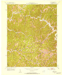
1950 Map of Lenox
USGS Topo · Published 1953About this map
The Licking River winds through the heart of Morgan County, carving a deep horseshoe bend at Cottle Bend as it flows past the mouth of Spaws Creek. This mid-century landscape is defined by its ridge-and-hollow settlement pattern, where small communities and family farms are concentrated along narrow watercourses like Lacy Creek and Elk Fork. The era’s rural infrastructure is remarkably intact, featuring a dense network of local landmarks including Gordon Ford and numerous one-room schoolhouses such as Hutchinson Sch and Banner Sch.
Find a feature on this map
57 named features on this map. Tap any name to fly to it.
Don’t see what you’re looking for? This feature index may not catch every label — zoom into the map to look around manually.
Map Details
Editions of this 1950 Lenox Map
This is the sole edition of this map. No revisions or reprints were ever made.
Other maps of this area

1889 · Salyersville
USGS Topo · 1:125,000

1891 · Salyersville
USGS Topo · 1:125,000

1899 · Salyersville
USGS Topo · 1:125,000

1929 · Morehead
USGS Topo · 1:48,000

1935 · Morehead
USGS Topo · 1:62,500

1950 · Isonville
USGS Topo · 1:24,000

1950 · Sandy Hook
USGS Topo · 1:24,000

1951 · Cannel City
USGS Topo · 1:24,000

1951 · White Oak
USGS Topo · 1:24,000
1951 · Dingus
USGS Topo · 1:24,000