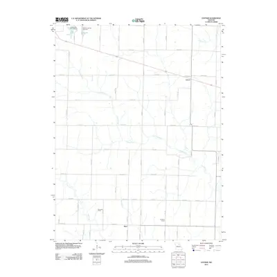
2012 Map of Lentner
USGS Topo · Published 2012About this map
Crooked Creek and its many winding tributaries define the rural character of this Shelby County landscape. The area is anchored by the small settlement of Lentner along the northern rail line and the community of Maud to the south. The northern edge of the map features significant municipal water infrastructure for the nearby city, including the Clarence City New Lake Dam and the Clarence City Old Lake Dam, which create New Lake and Old Lake respectively. These reservoirs, alongside the Panhandle District, illustrate the managed agricultural and utility land use of the early 21st century. The drainage patterns of Otter Creek and Ram Branch cut through a dense network of county roads, such as Highway TT and Highway DD, which connect the scattered farmsteads and the localized L-Z Bravo Airport.
Find a feature on this map
59 named features on this map. Tap any name to fly to it.
Don’t see what you’re looking for? This feature index may not catch every label — zoom into the map to look around manually.
Map Details
Editions of this 2012 Lentner Map
This is the sole edition of this map. No revisions or reprints were ever made.
Other maps of this area

1908 · Atlanta
USGS Topo · 1:62,500

1908 · Macon
USGS Topo · 1:62,500

1910 · Macon
USGS Topo · 1:62,500

1953 · Moberly
USGS Topo · 1:250,000

1954 · Moberly
USGS Topo · 1:250,000

1957 · Moberly
USGS Topo · 1:250,000

1958 · Lentner
USGS Topo · 1:24,000

1959 · Shelbina
USGS Topo · 1:24,000
1959 · Woodlawn
USGS Topo · 1:24,000

1960 · Moberly
USGS Topo · 1:250,000