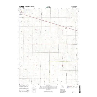
2014 Map of Lentner
USGS Topo · Published 2014About this map
Clarence sits at the northwestern edge of this Shelby County landscape, where the local terrain is defined by a dense network of country roads and winding waterways. The settlement of Lentner is positioned further east along the primary transportation route of Highway 36, while the small community of Maud is located to the south near the boundary with Monroe County. The drainage patterns of the region are dominated by Crooked Cr, which meanders across the center of the sheet, and Otter Cr in the southwest. Near Clarence, Old Lake and New Lake provide distinct landmarks in an area otherwise characterized by agricultural partitions and stream branches like Ram Br and Briggs Br. This detailed record captures the rural layout of the northern Missouri countryside, documenting the township lines and property divisions that have shaped local land use.
Find a feature on this map
61 named features on this map. Tap any name to fly to it.
Don’t see what you’re looking for? This feature index may not catch every label — zoom into the map to look around manually.
Map Details
Editions of this 2014 Lentner Map
This is the sole edition of this map. No revisions or reprints were ever made.
Other maps of this area

1908 · Atlanta
USGS Topo · 1:62,500

1908 · Macon
USGS Topo · 1:62,500

1910 · Macon
USGS Topo · 1:62,500

1953 · Moberly
USGS Topo · 1:250,000

1954 · Moberly
USGS Topo · 1:250,000

1957 · Moberly
USGS Topo · 1:250,000

1958 · Lentner
USGS Topo · 1:24,000

1959 · Shelbina
USGS Topo · 1:24,000
1959 · Woodlawn
USGS Topo · 1:24,000

1960 · Moberly
USGS Topo · 1:250,000