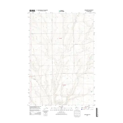
2013 Map of Lenzie Ranch
USGS Topo · Published 2013About this map
Lenzie Ranch serves as a primary landmark in this corner of Benton County, where the high desert landscape is defined by its agricultural grid and seasonal drainage patterns. The drainage of E Br Glade Cr cuts through the terrain, providing a natural break in the rectilinear network of rural roads that partition the land. These thoroughfares, such as Bert James Rd and Davis Rd, follow the section lines of t7n r25e and t6n r25e, illustrating the lasting influence of the Public Land Survey System on Eastern Washington's development. Local transit and access across the undulating plateau are facilitated by a series of named routes including Horrigan Rd, Rydeholm Rd, and Young Rd, which connect the isolated ranching operations and farmsteads scattered throughout the quadrangle.
Find a feature on this map
10 named features on this map. Tap any name to fly to it.
Don’t see what you’re looking for? This feature index may not catch every label — zoom into the map to look around manually.
Map Details
Editions of this 2013 Lenzie Ranch Map
This is the sole edition of this map. No revisions or reprints were ever made.
Other maps of this area

1906 · Blalock Island
USGS Topo · 1:125,000

1908 · Blalock Island
USGS Topo · 1:125,000

1915 · Prosser
USGS Topo · 1:125,000

1917 · Prosser
USGS Topo · 1:125,000

1953 · Pendleton
USGS Topo · 1:250,000

1953 · Walla Walla
USGS Topo · 1:250,000

1956 · Pendleton
USGS Topo · 1:250,000

1958 · Walla Walla
USGS Topo · 1:250,000

1962 · Canoe Ridge
USGS Topo · 1:24,000

1962 · Blalock Island
USGS Topo · 1:24,000