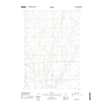
2020 Map of Lenzie Ranch
USGS Topo · Published 2020About this map
Lenzie Ranch and its surrounding high plateau define this section of Benton County, where the dry landscape is carved by seasonal drainages and local access roads. The map illustrates a rural area organized by a grid of Section lines and agricultural thoroughfares, including Horrigan Rd and Bert James Rd, which provide passage through the undulating terrain north of the Columbia River basin. The eastern portion of the quadrangle is marked by the course of E Br Glade Cr, which winds through the valley floors between ridges. This 2020 survey documents a region where ranching and large-scale land management dictate the settlement pattern, anchored by the namesake ranch in the southeast corner. The network of local roads such as Young Rd and Farnum Rd highlights the persistent utility of the range roads for the modern ranching operations found here.
Find a feature on this map
10 named features on this map. Tap any name to fly to it.
Don’t see what you’re looking for? This feature index may not catch every label — zoom into the map to look around manually.
Map Details
Editions of this 2020 Lenzie Ranch Map
This is the sole edition of this map. No revisions or reprints were ever made.
Other maps of this area

1906 · Blalock Island
USGS Topo · 1:125,000

1908 · Blalock Island
USGS Topo · 1:125,000

1915 · Prosser
USGS Topo · 1:125,000

1917 · Prosser
USGS Topo · 1:125,000

1953 · Pendleton
USGS Topo · 1:250,000

1953 · Walla Walla
USGS Topo · 1:250,000

1956 · Pendleton
USGS Topo · 1:250,000

1958 · Walla Walla
USGS Topo · 1:250,000

1962 · Canoe Ridge
USGS Topo · 1:24,000

1962 · Blalock Island
USGS Topo · 1:24,000