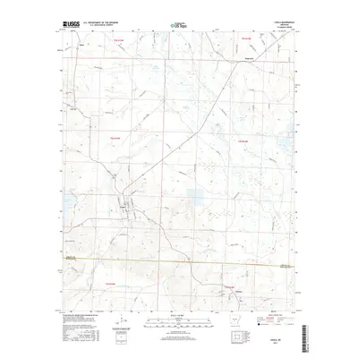
2017 Map of Leola
USGS Topo · Published 2017About this map
Leola serves as the central hub of this survey area, situated at the boundary between Grant and Dallas Counties. The landscape is defined by the winding course of the Saline River, which feeds into a complex network of wetlands and tributaries such as Moores Slough and Beaverdam Slough. Small rural settlements like Dogwood, Thiel, and Carver are scattered throughout the northern sections, while the southern reaches near the county line include Cooney and Ivy.
Find a feature on this map
76 named features on this map. Tap any name to fly to it.
Don’t see what you’re looking for? This feature index may not catch every label — zoom into the map to look around manually.
Map Details
Editions of this 2017 Leola Map
This is the sole edition of this map. No revisions or reprints were ever made.
Other maps of this area

1955 · Little Rock
USGS Topo · 1:250,000

1956 · Little Rock
USGS Topo · 1:250,000

1960 · Little Rock
USGS Topo · 1:250,000

1963 · Prattsville
USGS Topo · 1:24,000

1964 · Poyen
USGS Topo · 1:24,000

1964 · Little Rock
USGS Topo · 1:250,000

1964 · Sheridan
USGS Topo · 1:24,000

1964 · Bunn
USGS Topo · 1:24,000
1964 · Millerville
USGS Topo · 1:24,000
1965 · Leola
USGS Topo · 1:24,000