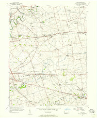
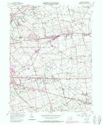
1956 Map of Leola
USGS Topo · Published 1957About this map
Pennsylvania Railroad tracks and the busy Lincoln Highway anchor this mid-century portrait of Lancaster County's agricultural heartland. The landscape is defined by a dense network of small crossroads settlements like Bird in Hand, Smoketown, and Leola, reflecting a rural society built around local institutions. Numerous schools, such as Weavertown Sch and East Lampeter High Sch, alongside historic meeting houses like Mellingers Ch and Carpenter Ch, reveal the community structure of the 1950s.
Find a feature on this map
97 named features on this map. Tap any name to fly to it.
Don’t see what you’re looking for? This feature index may not catch every label — zoom into the map to look around manually.
Map Details
Editions of this 1956 Leola Map
5 editions found
Other maps of this area

1902 · Lancaster
USGS Topo · 1:62,500

1904 · Lancaster
USGS Topo · 1:62,500

1906 · New Holland
USGS Topo · 1:62,500

1908 · New Holland
USGS Topo · 1:62,500

1912 · Quarryville
USGS Topo · 1:62,500

1912 · Mc Calls Ferry
USGS Topo · 1:62,500

1941 · New Holland
USGS Topo · 1:62,500

1943 · Lancaster
USGS Topo · 1:62,500

1943 · Quarryville
USGS Topo · 1:62,500

1943 · Mc Calls Ferry
USGS Topo · 1:62,500
Featured Places
- West Lampeter Township, PA
- Leacock, Upper Leacock Township
- Paradise Township, PA
- Brownstown, West Earl Township
- Manheim Township, PA