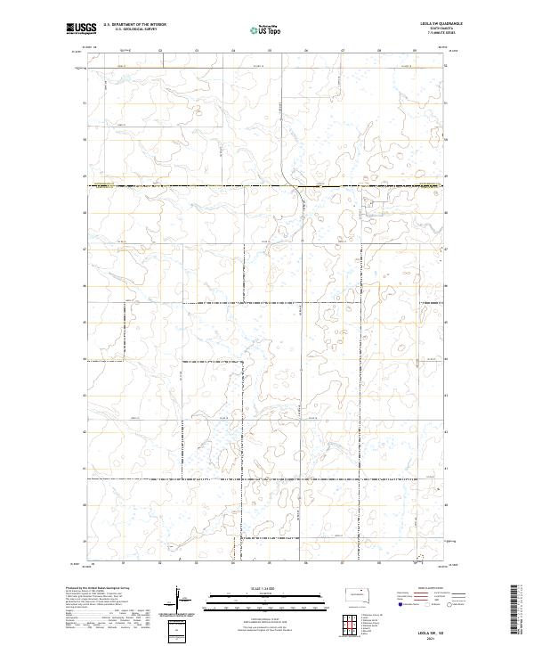
2021 Map of Leola SW
USGS Topo · Published 2021About this map
Glacial potholes and prairie wetlands define the landscape of the northern Great Plains along the border of McPherson Co and Edmunds Co. This 2021 survey documents the rural section-line road grid that organizes the South Dakota countryside, where Co Hwy 18 and Co Rd 16 serve as primary east-west corridors. The map provides a detailed view of the complex hydrography characteristic of the Coteau des Prairies, showing a dense concentration of small water bodies and seasonal wetlands that dictate the placement of local routes like 124th St and 363rd Ave. The lack of named settlements emphasizes the agricultural and environmental character of this region, where land usage is largely governed by the township and range divisions of t124n r67w and surrounding sections.
Find a feature on this map
25 named features on this map. Tap any name to fly to it.
Don’t see what you’re looking for? This feature index may not catch every label — zoom into the map to look around manually.
Map Details
Editions of this 2021 Leola SW Map
This is the sole edition of this map. No revisions or reprints were ever made.
Other maps of this area

1899 · Ellendale
USGS Topo · 1:125,000

1899 · Northville
USGS Topo · 1:125,000

1954 · Aberdeen
USGS Topo · 1:250,000

1956 · Aberdeen
USGS Topo · 1:250,000

1970 · Wetonka South
USGS Topo · 1:24,000

1970 · Mina NW
USGS Topo · 1:24,000

1970 · Leola
USGS Topo · 1:24,000
1970 · Mina
USGS Topo · 1:24,000
1970 · Wetonka North
USGS Topo · 1:24,000

1970 · Leola SW
USGS Topo · 1:24,000