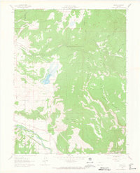
1961 Map of Leon
USGS Topo · Published 1966About this map
The Roaring Fork River valley serves as the primary corridor for settlement and transit in this early 1960s survey of the Garfield and Eagle County line. The tracks of the Denver and Rio Grande Western railroad follow the river's course, passing the small settlement of El Jebel and the rail stop at Leon. This valley floor contrasts sharply with the massive rise of Basalt Mountain to the east and the high meadows of High Park.
Find a feature on this map
23 named features on this map. Tap any name to fly to it.
Don’t see what you’re looking for? This feature index may not catch every label — zoom into the map to look around manually.
Map Details
Editions of this 1961 Leon Map
4 editions found
Other maps of this area

1909 · Mount Jackson
USGS Topo · 1:125,000

1911 · Mount Jackson
USGS Topo · 1:125,000

1927 · Glenwood Springs
USGS Topo · 1:125,000

1930 · Glenwood Springs
USGS Topo · 1:125,000

1957 · Leadville
USGS Topo · 1:250,000

1959 · Leadville
USGS Topo · 1:250,000

1960 · Leadville
USGS Topo · 1:250,000

1961 · Mount Sopris
USGS Topo · 1:24,000

1961 · Carbondale
USGS Topo · 1:24,000

1961 · Leon
USGS Topo · 1:24,000