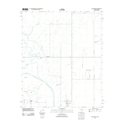
2012 Map of Leon North
USGS Topo · Published 2012About this map
The Red River defines the southern boundary of this region, winding past the community of Illinois Bend where the river makes a pronounced southern arc. In the southeast corner, the town of Leon is organized on a traditional grid, featuring named thoroughfares like River St and 7th St. The landscape is a network of rural watercourses including Coffeepot Cr, Red Oak Cr, and Mud Cr that drain the territory north of the primary river valley.
Find a feature on this map
41 named features on this map. Tap any name to fly to it.
Don’t see what you’re looking for? This feature index may not catch every label — zoom into the map to look around manually.
Map Details
Editions of this 2012 Leon North Map
This is the sole edition of this map. No revisions or reprints were ever made.
Other maps of this area

1901 · Addington
USGS Topo · 1:125,000

1901 · Ardmore
USGS Topo · 1:125,000

1902 · Gainesville
USGS Topo · 1:125,000

1905 · Montague
USGS Topo · 1:125,000

1918 · Ardmore
USGS Topo · 1:125,000

1943 · Gainesville
USGS Topo · 1:125,000

1954 · Sherman
USGS Topo · 1:250,000

1957 · Ardmore
USGS Topo · 1:250,000

1958 · Sherman
USGS Topo · 1:250,000

1963 · Ardmore
USGS Topo · 1:250,000