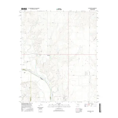
2016 Map of Leon North
USGS Topo · Published 2016About this map
The Red River marks the winding border between Oklahoma and Texas, defining the southern landscape of this 2016 survey. The small community of Leon anchors the southeastern corner, where local streets like River St and Church St intersect near the Leon Cem. To the northwest, the settlement of Rubottom sits at a crossroads, supported by its own namesake Rubottom Cem and the nearby James Pond 6. This rural area is characterized by a network of creeks, including Mud Creek and Coffeepot Cr, which drain toward the river through the Illinois Bend region. Genealogists and local historians can trace family ties through several outlying burial sites such as Murrell Cem and Courtney Cem, while land researchers can observe the modern parcel divisions indicated by numerous numbered rural roads spanning Love County.
Find a feature on this map
46 named features on this map. Tap any name to fly to it.
Don’t see what you’re looking for? This feature index may not catch every label — zoom into the map to look around manually.
Map Details
Editions of this 2016 Leon North Map
This is the sole edition of this map. No revisions or reprints were ever made.
Other maps of this area

1901 · Addington
USGS Topo · 1:125,000

1901 · Ardmore
USGS Topo · 1:125,000

1902 · Gainesville
USGS Topo · 1:125,000

1905 · Montague
USGS Topo · 1:125,000

1918 · Ardmore
USGS Topo · 1:125,000

1943 · Gainesville
USGS Topo · 1:125,000

1954 · Sherman
USGS Topo · 1:250,000

1957 · Ardmore
USGS Topo · 1:250,000

1958 · Sherman
USGS Topo · 1:250,000

1963 · Ardmore
USGS Topo · 1:250,000