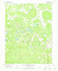
1960 Map of Leon Peak
USGS Topo · Published 1973About this map
High-altitude water management systems define this Colorado landscape as recorded during a 1960 field check. The area is characterized by a network of drainage and storage, including the Lambert Reservoir and Kenny Creek Reservoir, which likely served the surrounding agricultural or ranching communities at the edge of the Delta County line. These man-made features are connected by natural drainages like Youngs Creek and Pretty Creek, illustrating the vital role of snowmelt capture in this environment. To the north, Youngs Lake and Anderson Reservoir provide further evidence of the systematic development of water resources on the mesa during the mid-twentieth century.
Find a feature on this map
6 named features on this map. Tap any name to fly to it.
Don’t see what you’re looking for? This feature index may not catch every label — zoom into the map to look around manually.
Map Details
Editions of this 1960 Leon Peak Map
5 editions found

Other maps of this area

1955 · Collbran
USGS Topo · 1:24,000

1955 · Grand Mesa
USGS Topo · 1:24,000

1955 · The Meadows
USGS Topo · 1:24,000

1956 · Montrose
USGS Topo · 1:250,000

1957 · Leadville
USGS Topo · 1:250,000

1959 · Leadville
USGS Topo · 1:250,000

1959 · Montrose
USGS Topo · 1:250,000

1960 · Leadville
USGS Topo · 1:250,000

1960 · Montrose
USGS Topo · 1:250,000

1960 · Leon Peak
USGS Topo · 1:24,000