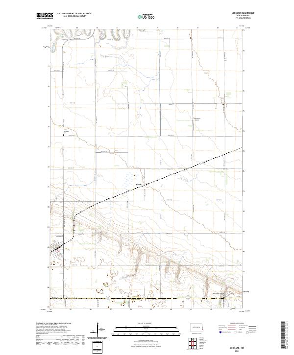
2024 Map of Leonard
USGS Topo · Published 2024About this map
Leonard and Woods anchor this agricultural landscape on the border of Cass Co and Richland Co. The northern reaches are defined by the meandering course of the Maple River, while the surrounding terrain is organized by a precise grid of section roads and administrative township lines. Religious and community history is preserved at the Bethel Moravian Cem and West Prairie Lutheran Cem, which stand as quiet landmarks among the expansive fields. The presence of Plath Farms Airport highlights the specialized aviation needs of modern prairie farming, while the road network, including names like Railroad Ave N, suggests a legacy of rail-driven settlement. This area remains a quintessential example of the Red River Valley's rural development and agricultural continuity.
Find a feature on this map
42 named features on this map. Tap any name to fly to it.
Don’t see what you’re looking for? This feature index may not catch every label — zoom into the map to look around manually.
Map Details
Editions of this 2024 Leonard Map
This is the sole edition of this map. No revisions or reprints were ever made.
Other maps of this area

1895 · Casselton
USGS Topo · 1:125,000

1897 · Casselton
USGS Topo · 1:125,000

1953 · Fargo
USGS Topo · 1:250,000

1956 · Fargo
USGS Topo · 1:250,000

1959 · Kindred
USGS Topo · 1:24,000

1959 · Leonard
USGS Topo · 1:24,000

1960 · Power
USGS Topo · 1:24,000

1960 · Barrie
USGS Topo · 1:24,000

1960 · Coburn
USGS Topo · 1:24,000

1961 · Durbin
USGS Topo · 1:24,000