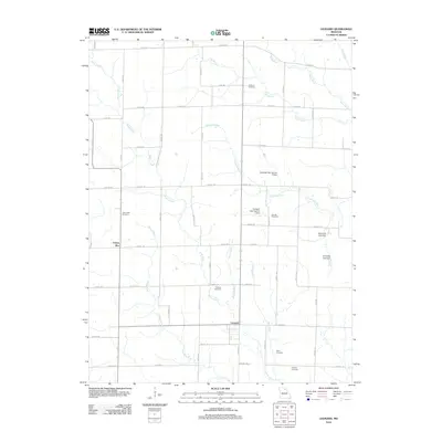
2012 Map of Leonard
USGS Topo · Published 2012About this map
Leonard and Cherry Box anchor this rural landscape in Shelby County, defined by a dense network of country roads and family-named watercourses. The terrain is deeply etched by Black Creek and the North River, with numerous tributaries like Garnett Branch and Hilton Branch feeding into the drainage system. This area serves as a significant record for genealogists, as it preserves the locations of several community burial grounds, including Antioch Cemetery, Cockrum Cemetery, and Peoples Cemetery. Local infrastructure is marked by several small impoundments such as the Browning Lake Dam and the Caldwell Lake Section 7 Dam. The map reveals a traditional Missouri agricultural layout, where section lines dictate the path of routes like Shelby 118 and Shelby 120, connecting dispersed farmsteads to the central hubs of Leonard and Cherry Box.
Find a feature on this map
67 named features on this map. Tap any name to fly to it.
Don’t see what you’re looking for? This feature index may not catch every label — zoom into the map to look around manually.
Map Details
Editions of this 2012 Leonard Map
This is the sole edition of this map. No revisions or reprints were ever made.
Other maps of this area

1903 · Edina
USGS Topo · 1:125,000

1908 · Atlanta
USGS Topo · 1:62,500

1953 · Moberly
USGS Topo · 1:250,000

1954 · Centerville
USGS Topo · 1:250,000

1954 · Moberly
USGS Topo · 1:250,000

1957 · Moberly
USGS Topo · 1:250,000

1957 · Centerville
USGS Topo · 1:250,000

1958 · Centerville
USGS Topo · 1:250,000

1960 · Moberly
USGS Topo · 1:250,000
1963 · Leonard
USGS Topo · 1:24,000